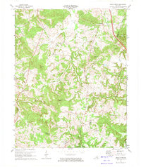
1973 Map of Sugar Grove
USGS Topo · Published 1974About this map
The boundary between Butler and Warren Counties defines the eastern portion of this landscape, where the terrain shifts between the drainage of Little Muddy Creek and the Gasper River. This 1973 field-checked survey reveals a rural network of small communities and family landmarks, including the crossroads at Sugar Grove and the southern settlement of Richelieu. Genealogists will find a wealth of specific data, as the map identifies numerous family burial grounds such as McKinney Cem, Guthrie Cem, and Lee Cem, often located near local congregations like Shiloh Ch and Richland Ch.
Find a feature on this map
46 named features on this map. Tap any name to fly to it.
Don’t see what you’re looking for? This feature index may not catch every label — zoom into the map to look around manually.
Map Details
Editions of this 1973 Sugar Grove Map
This is the sole edition of this map. No revisions or reprints were ever made.
Other maps of this area

1911 · Dunmor
USGS Topo · 1:48,000

1914 · Little Muddy
USGS Topo · 1:62,500

1914 · Dunmor
USGS Topo · 1:62,500

1951 · South Union
USGS Topo · 1:24,000

1951 · Homer
USGS Topo · 1:24,000

1952 · Rockfield
USGS Topo · 1:24,000

1953 · South Hill
USGS Topo · 1:24,000

1953 · Quality
USGS Topo · 1:24,000

1954 · Evansville
USGS Topo · 1:250,000
1954 · Hadley
USGS Topo · 1:24,000