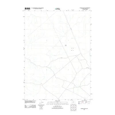
2012 Map of Sugar Loaf NE
USGS Topo · Published 2012About this map
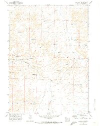
Alkali Cr winds through this high desert terrain in Sublette County, defining the drainage patterns of a landscape shaped by intermittent water and arid draws. The presence of Sand Draw indicates the sedimentary nature of the local topography, where seasonal runoff carved the earth long before modern road networks were established. Transportation across this portion of the Wyoming basin is facilitated by a network of unimproved and bureau-managed routes, most notably Burma Rd and the Bureau of Land Management road Blm 5404. These corridors reflect the region's historical and ongoing reliance on access roads for livestock management and resource extraction. The intersection of Yellow Point Rd provides further evidence of the sparse but vital infrastructure connecting this remote Wyoming territory in the early twenty-first century.
Find a feature on this map
5 named features on this map. Tap any name to fly to it.
Don’t see what you’re looking for? This feature index may not catch every label — zoom into the map to look around manually.
Map Details
Editions of this 2012 Sugar Loaf NE Map
This is the sole edition of this map. No revisions or reprints were ever made.
Other maps of this area

1955 · Lander
USGS Topo · 1:250,000

1958 · Lander
USGS Topo · 1:250,000

1961 · Lander
USGS Topo · 1:250,000

1964 · Ross Butte
USGS Topo · 1:24,000
1964 · Olsen Ranch
USGS Topo · 1:24,000

1969 · Oasis Well
USGS Topo · 1:24,000
1969 · Sugar Loaf
USGS Topo · 1:24,000
1969 · Teakettle Butte
USGS Topo · 1:24,000
1969 · Sugar Loaf NW
USGS Topo · 1:24,000
1969 · Sugar Loaf NE
USGS Topo · 1:24,000