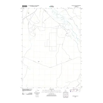
2010 Map of Sugar Valley
USGS Topo · Published 2010About this map
The Bruneau River winds through this desert landscape, its course marked by a complex system of local irrigation infrastructure including the South Side Canal, Bieroth Canal, and Buckaroo Ditch. The map illustrates a region defined by its water management and sparse ranching history, centered near the settlement of Sugar Valley. Geologic and cultural landmarks punctuate the terrain, notably the City of Rocks to the south and the O X Cemetery situated near Hot Creek Rd. This 2010 survey by the U.S. Geological Survey documents the intersection of natural drainages like Sugar Creek and Jacks Creek with a grid of rural routes such as Pipeline Rd and Sugar Valley Rd, revealing how the high desert environment has been navigated and utilized for decades.
Find a feature on this map
15 named features on this map. Tap any name to fly to it.
Don’t see what you’re looking for? This feature index may not catch every label — zoom into the map to look around manually.
Map Details
Editions of this 2010 Sugar Valley Map
This is the sole edition of this map. No revisions or reprints were ever made.
Other maps of this area

1946 · Mouth of Bruneau
USGS Topo · 1:24,000

1947 · Little Valley
USGS Topo · 1:24,000

1947 · Bruneau
USGS Topo · 1:62,500

1947 · Sand Dunes
USGS Topo · 1:24,000

1947 · Bruneau
USGS Topo · 1:24,000

1947 · Sugar Valley
USGS Topo · 1:24,000

1947 · Hot Spring
USGS Topo · 1:24,000

1948 · Sand Dunes
USGS Topo · 1:24,000
1948 · Little Valley
USGS Topo · 1:24,000

1948 · Sugar Valley
USGS Topo · 1:24,000