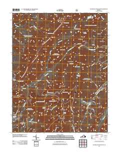
2011 Map of Sugarloaf Mountain
USGS Topo · Published 2011About this map
Jane Furnace and Rebecca Furnace stand as markers of early industrial activity along the waters of Smith Branch and Limestone Hollow in this corner of the Blue Ridge. The landscape is defined by a dense network of ridges and hollows, where the high point of Sugarloaf Mountain overlooks a geography shaped by the drainage of North Buffalo Creek and South Buffalo Creek. The small community of Rapps Mill serves as a local focal point near the eastern edge, supported by legacy sites like Rapps Cemetery.
Find a feature on this map
68 named features on this map. Tap any name to fly to it.
Don’t see what you’re looking for? This feature index may not catch every label — zoom into the map to look around manually.
Map Details
Editions of this 2011 Sugarloaf Mountain Map
This is the sole edition of this map. No revisions or reprints were ever made.
Other maps of this area

1894 · Natural Bridge
USGS Topo · 1:125,000

1894 · Natural Bridge
USGS Topo · 1:62,500

1907 · Natural Bridge Special
USGS Topo · 1:62,500

1913 · Eagle Rock
USGS Topo · 1:48,000

1915 · Eagle Rock
USGS Topo · 1:62,500

1945 · Clifton Forge
USGS Topo · 1:62,500

1946 · Millboro
USGS Topo · 1:62,500

1947 · Roanoke
USGS Topo · 1:250,000
1949 · Clifton Forge
USGS Topo · 1:62,500
1949 · Millboro
USGS Topo · 1:62,500