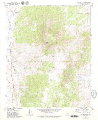
1979 Map of Sullivan Buttes
USGS Topo · Published 1979About this map
Sullivan Buttes and the surrounding volcanic terrain of Yavapai County dominate this 1970s landscape, defined by a complex network of seasonal drainages and cattle ranching infrastructure. The Atchison Topeka and Santa Fe railroad corridor cuts through the western edge of the quadrangle, serving local points like Tucker Siding near Mint Wash. The arid environment is marked by numerous water collection points essential for livestock, such as Pemberton Tank, Scissor Tank, and Miller Dam Tank.
Find a feature on this map
26 named features on this map. Tap any name to fly to it.
Don’t see what you’re looking for? This feature index may not catch every label — zoom into the map to look around manually.
Map Details
Editions of this 1979 Sullivan Buttes Map
3 editions found
Other maps of this area

1887 · Prescott
USGS Topo · 1:250,000

1892 · Prescott
USGS Topo · 1:250,000

1905 · Jerome
USGS Topo · 1:125,000

1947 · Simmons
USGS Topo · 1:62,500

1947 · Iron Springs
USGS Topo · 1:62,500

1947 · Paulden
USGS Topo · 1:62,500

1947 · Prescott
USGS Topo · 1:62,500

1948 · Iron Springs
USGS Topo · 1:63,360

1948 · Prescott
USGS Topo · 1:62,500

1948 · Simmons
USGS Topo · 1:63,360