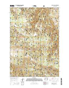
2014 Map of Sullivan Gulch
USGS Topo · Published 2014About this map
Whitman National Forest and Umatilla National Forest converge in this high-country landscape, marked by a dense network of water sources and forestry roads. The terrain is defined by dramatic drainage systems like Sullivan Gulch and Cougar Canyon, which draw from numerous named springs including Sullivan Spring, Blarney Spring, and the curiously named Tin Troughs Spring. These water points were critical for livestock and timber operations throughout the mid-20th century, particularly near the expansive Frog Heaven Meadow.
Find a feature on this map
62 named features on this map. Tap any name to fly to it.
Don’t see what you’re looking for? This feature index may not catch every label — zoom into the map to look around manually.
Map Details
Editions of this 2014 Sullivan Gulch Map
This is the sole edition of this map. No revisions or reprints were ever made.
Other maps of this area

1953 · Pendleton
USGS Topo · 1:250,000

1956 · Pendleton
USGS Topo · 1:250,000

1964 · Mc Intyre Creek
USGS Topo · 1:24,000

1965 · Marley Creek
USGS Topo · 1:24,000

1965 · Fly Valley
USGS Topo · 1:24,000

1967 · Tower Mtn
USGS Topo · 1:24,000

1967 · Sullivan Gulch
USGS Topo · 1:24,000

1967 · Lehman Springs
USGS Topo · 1:24,000

1967 · Bally Mountain
USGS Topo · 1:24,000

1967 · Pearson Ridge
USGS Topo · 1:24,000