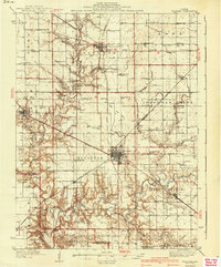
1940 Map of Sullivan
USGS Topo · Published 1940About this map
Sullivan serves as the central hub of this Central Illinois landscape, surrounded by a dense network of late-Depression era rural infrastructure. The map reveals an intricate web of transportation, where the Illinois Central, Wabash, and Chicago and Eastern Illinois railroads converge near the heart of Moultrie Co. These rails supported a farming economy characterized by small, family-named landmarks like the Masonic Home and the Coal Shaft Bridge over the Kaskaskia River.
Find a feature on this map
96 named features on this map. Tap any name to fly to it.
Don’t see what you’re looking for? This feature index may not catch every label — zoom into the map to look around manually.
Map Details
Editions of this 1940 Sullivan Map
2 editions found
Other maps of this area

1929 · Decatur
USGS Topo · 1:62,500

1933 · Decatur
USGS Topo · 1:62,500

1934 · Mattoon
USGS Topo · 1:62,500

1935 · Arcola
USGS Topo · 1:48,000

1935 · Sullivan
USGS Topo · 1:48,000

1937 · Mattoon
USGS Topo · 1:62,500

1940 · Sullivan
USGS Topo · 1:62,500

1940 · Arcola
USGS Topo · 1:62,500

1942 · Shelbyville
USGS Topo · 1:62,500

1946 · Shelbyville
USGS Topo · 1:62,500