
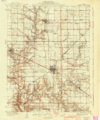
1940 Map of Sullivan
USGS Topo · Published 1940About this map
Sullivan and the surrounding townships of Lovington, Jonathan Creek, and East Nelson are depicted here during a period of established agricultural and industrial connectivity. The landscape is defined by a dense network of over two dozen one-room country schools, including Stringtown Sch, Mayflower Sch, and Mt Pleasant Sch, which illustrate the community-centered rural life of Central Illinois in the mid-1930s. The regional economy is anchored by significant rail infrastructure, with the Pennsylvania and Chicago and Eastern Illinois railroads intersecting the territory.
Find a feature on this map
101 named features on this map. Tap any name to fly to it.
Don’t see what you’re looking for? This feature index may not catch every label — zoom into the map to look around manually.
Map Details
Editions of this 1940 Sullivan Map
2 editions found
Other maps of this area

1929 · Decatur
USGS Topo · 1:62,500

1933 · Decatur
USGS Topo · 1:62,500

1934 · Mattoon
USGS Topo · 1:62,500

1935 · Arcola
USGS Topo · 1:48,000

1935 · Sullivan
USGS Topo · 1:48,000

1937 · Mattoon
USGS Topo · 1:62,500

1940 · Arcola
USGS Topo · 1:62,500

1942 · Shelbyville
USGS Topo · 1:62,500

1946 · Shelbyville
USGS Topo · 1:62,500

1947 · Stewardson
USGS Topo · 1:62,500