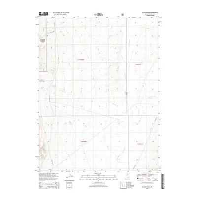
2015 Map of Sullivan Wash
USGS Topo · Published 2015About this map
Antelope Valley defines this stretch of central Nevada, where ephemeral drainage systems and ranching roads weave through the high desert. The map captures a landscape focused on water management and forest boundaries in the early 21st century, anchored by the Allison Creek Reservoir and the eastern edge of the Toiyabe National Forest. The topography is dominated by several significant desert washes, including the central Sullivan Wash and the northern Fenstermaker Wash, which channel seasonal runoff from the surrounding ranges. Transportation in this section of Eureka County is limited to a few established routes such as Antelope Valley Rd and Cedar Creek Rd, reflecting the sparse settlement and agricultural character of the region. This survey is particularly useful for understanding modern land use, section boundaries like t17n r50e, and the drainage patterns of small tributaries like Copenhagen Cr and Willow Cr.
Find a feature on this map
17 named features on this map. Tap any name to fly to it.
Don’t see what you’re looking for? This feature index may not catch every label — zoom into the map to look around manually.
Map Details
Editions of this 2015 Sullivan Wash Map
This is the sole edition of this map. No revisions or reprints were ever made.
Other maps of this area

1926 · Roberts Mountains
USGS Topo · 1:250,000

1929 · Roberts Mountains
USGS Topo · 1:250,000

1955 · Millett
USGS Topo · 1:250,000

1956 · Bellevue Peak
USGS Topo · 1:62,500

1956 · Cockalorum Wash
USGS Topo · 1:62,500

1956 · Horse Heaven Mtn
USGS Topo · 1:62,500

1956 · Antelope Peak
USGS Topo · 1:62,500

1959 · Millett
USGS Topo · 1:250,000

1978 · Summit Mountain
USGS Topo · 1:100,000
1989 · Ninemile Peak
USGS Topo · 1:24,000