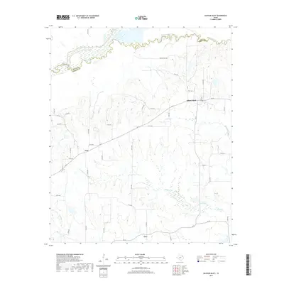
2019 Map of Sulphur Bluff
USGS Topo · Published 2019About this map
Sulphur Bluff and Nelta define this rural landscape in Hopkins County, characterized by the winding path of the South Sulphur River along the northern boundary. The terrain is marked by a series of creek drainages including Mitchell Cr, Wolfpen Cr, and Morgan Cr that cross the county line into Delta County. This 2019 survey documents a modern rural environment where historic settlement patterns persist alongside agricultural developments like Dunham Ranch Rd. Local landowners and genealogists can trace the geography of the Flora community and the R A Jordan Estate Lake, observing how current state and county roads, such as FM 71 and FM 69, connect these traditional North Texas hamlets. The map provides a detailed view of the water network that continues to shape the region’s land use and property divisions.
Find a feature on this map
45 named features on this map. Tap any name to fly to it.
Don’t see what you’re looking for? This feature index may not catch every label — zoom into the map to look around manually.
Map Details
Editions of this 2019 Sulphur Bluff Map
This is the sole edition of this map. No revisions or reprints were ever made.
Other maps of this area

1953 · Texarkana
USGS Topo · 1:250,000

1956 · Texarkana
USGS Topo · 1:250,000

1962 · Sulphur Bluff
USGS Topo · 1:24,000

1963 · Mitchell Creek
USGS Topo · 1:24,000

1963 · Minter
USGS Topo · 1:24,000

1963 · Cunningham
USGS Topo · 1:24,000

1964 · Saltillo
USGS Topo · 1:24,000

1964 · Sulphur Springs
USGS Topo · 1:24,000

1964 · Charleston
USGS Topo · 1:24,000

1964 · Tira
USGS Topo · 1:24,000