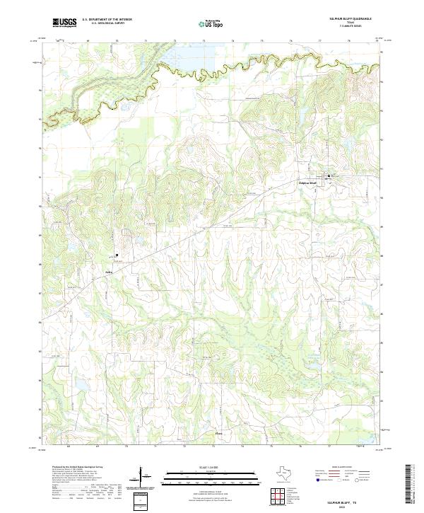
2022 Map of Sulphur Bluff
USGS Topo · Published 2022About this map
Sulphur Bluff sits at the heart of this North Texas landscape, where the South Sulphur River forms the natural boundary between Delta and Hopkins counties. The area's rural character is defined by a network of farm-to-market roads and county routes that connect small settlements like Nelta and Flora. For those tracing local families, the Sulfur Bluff Cem and Nelta Cem provide specific points of reference near their respective communities. The terrain is deeply etched by a system of waterways, including Wolfpen Cr, Mitchell Cr, and Morgan Cr, which drain toward the river valley. Notable private landmarks like the D A Jordan Estate Lake and Dunham Ranch Rd suggest the long-standing agricultural and ranching heritage that continues to shape the region’s development and land use patterns.
Find a feature on this map
47 named features on this map. Tap any name to fly to it.
Don’t see what you’re looking for? This feature index may not catch every label — zoom into the map to look around manually.
Map Details
Editions of this 2022 Sulphur Bluff Map
This is the sole edition of this map. No revisions or reprints were ever made.
Other maps of this area

1953 · Texarkana
USGS Topo · 1:250,000

1956 · Texarkana
USGS Topo · 1:250,000

1962 · Sulphur Bluff
USGS Topo · 1:24,000

1963 · Mitchell Creek
USGS Topo · 1:24,000

1963 · Minter
USGS Topo · 1:24,000

1963 · Cunningham
USGS Topo · 1:24,000

1964 · Saltillo
USGS Topo · 1:24,000

1964 · Sulphur Springs
USGS Topo · 1:24,000

1964 · Charleston
USGS Topo · 1:24,000

1964 · Tira
USGS Topo · 1:24,000