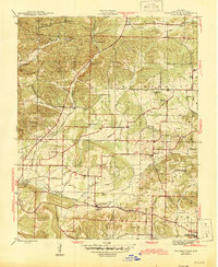
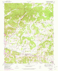
1943 Map of Sulphur Rock
USGS Topo · Published 1945About this map
Ozark No 1 Mine and the active tracks of the Missouri Pacific railroad define the industrial landscape of Independence County during the early 1940s. The region is marked by a network of rural settlements and community hubs, including Sulphur Rock, Moorefield, and Gainsboro. The local economy and social fabric are visible through the distribution of numerous country schools like Brewer Sch and Pfeiffer Sch, as well as a high concentration of small cemeteries such as Rehoboth Cem and Hadcock Cem.
Find a feature on this map
51 named features on this map. Tap any name to fly to it.
Don’t see what you’re looking for? This feature index may not catch every label — zoom into the map to look around manually.
Map Details
Editions of this 1943 Sulphur Rock Map
6 editions found

Other maps of this area

1890 · Batesville
USGS Topo · 1:125,000

1891 · Batesville
USGS Topo · 1:125,000

1932 · Strawberry
USGS Topo · 1:62,500

1935 · Strawberry
USGS Topo · 1:62,500

1935 · Newport
USGS Topo · 1:62,500

1941 · Strawberry
USGS Topo · 1:62,500

1942 · Jamestown
USGS Topo · 1:31,680

1942 · Salado
USGS Topo · 1:31,680

1942 · Batesville
USGS Topo · 1:31,680

1943 · Sandtown
USGS Topo · 1:24,000