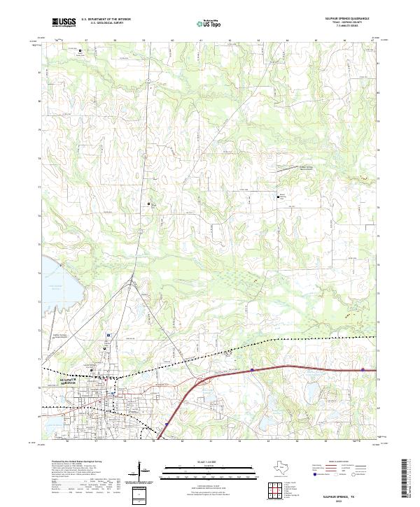
2022 Map of Sulphur Springs
USGS Topo · Published 2022About this map
Sulphur Springs serves as the focal point of this Hopkins County survey, where the historic Hopkins County Courthouse anchors the downtown grid. The landscape surrounding the city is defined by a series of small, family-named water bodies and creeks, including Horse Pen Cr and Midget Cr, which feed into larger reservoirs like Lake Sulphur Springs and Lake Coleman. This area preserves several significant historical burial grounds that point to the region's early settlement patterns, such as Old Tarrant Cem north of town and Mount Sterling Cem further east. The infrastructure reflects a balance between rural farmland and municipal expansion, evidenced by the presence of the Sulphur Springs Municipal Airport and the smaller Hidden Springs Ranch Airport. To the south and east, a complex network of reservoirs including Helm Lake Number 2 and Gooding Lake shapes the local drainage into Landers Cr.
Find a feature on this map
126 named features on this map. Tap any name to fly to it.
Don’t see what you’re looking for? This feature index may not catch every label — zoom into the map to look around manually.
Map Details
Editions of this 2022 Sulphur Springs Map
This is the sole edition of this map. No revisions or reprints were ever made.
Other maps of this area

1953 · Texarkana
USGS Topo · 1:250,000

1956 · Texarkana
USGS Topo · 1:250,000

1962 · Sulphur Bluff
USGS Topo · 1:24,000

1962 · Brashear
USGS Topo · 1:24,000

1964 · Como
USGS Topo · 1:24,000

1964 · Sulphur Springs
USGS Topo · 1:24,000

1964 · Gafford Chapel
USGS Topo · 1:24,000

1964 · Tira
USGS Topo · 1:24,000
1964 · Cooper South
USGS Topo · 1:24,000
1964 · Sulphur Springs SE
USGS Topo · 1:24,000