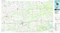
1985 Map of Sulphur Springs
USGS Topo · Published 1985About this map
The Sulphur River system, including its north, south, and middle forks, dominates this Northeast Texas landscape, defining the boundaries and drainage of multiple counties. The 1980s saw significant reservoir development across this region, evidenced by the presence of Lake Bob Sandlin, Lake Cypress Springs, and Lake Monticello in the southeast. These man-made water bodies altered the character of the traditional agricultural and ranching terrain, though the network of rural communities remains dense. Settlement hubs like Sulphur Springs and Commerce are connected by a web of regional infrastructure, including the St Louis Southwestern RR and Santa Fe RR. Throughout the countryside, landmarks like Sulphur Bluff and Farmers Academy point to the local history of education and topography that shaped the area's development before the widespread creation of modern reservoirs.
Find a feature on this map
167 named features on this map. Tap any name to fly to it.
Don’t see what you’re looking for? This feature index may not catch every label — zoom into the map to look around manually.
Map Details
Editions of this 1985 Sulphur Springs Map
This is the sole edition of this map. No revisions or reprints were ever made.
Other maps of this area

1903 · Paris
USGS Topo · 1:125,000

1947 · Honey Grove
USGS Topo · 1:62,500

1948 · Paris
USGS Topo · 1:62,500

1949 · Honey Grove
USGS Topo · 1:62,500

1949 · Paris
USGS Topo · 1:62,500

1950 · Annona
USGS Topo · 1:24,000

1951 · Annona
USGS Topo · 1:24,000

1953 · Texarkana
USGS Topo · 1:250,000

1954 · Dallas
USGS Topo · 1:250,000

1954 · Sherman
USGS Topo · 1:250,000