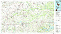
1991 Map of Sulphur Springs
USGS Topo · Published 1991About this map
Sulphur Springs and Commerce serve as the primary hubs in this Northeast Texas landscape, where a dense network of watercourses converges into the Sulphur River system. The map documents the branching forks of the Sulphur—North, Middle, and South—alongside the expansive waters of Cypress Springs Lake and Bob Sandlin Lake. The infrastructure of the early 1990s is clearly defined by the St Louis Southwestern RR and the Kansas City Southern RR, while an Old Railroad Grade hints at earlier transportation corridors no longer in active service.
Find a feature on this map
165 named features on this map. Tap any name to fly to it.
Don’t see what you’re looking for? This feature index may not catch every label — zoom into the map to look around manually.
Map Details
Editions of this 1991 Sulphur Springs Map
This is the sole edition of this map. No revisions or reprints were ever made.
Other maps of this area

1903 · Paris
USGS Topo · 1:125,000

1947 · Honey Grove
USGS Topo · 1:62,500

1948 · Paris
USGS Topo · 1:62,500

1949 · Honey Grove
USGS Topo · 1:62,500

1949 · Paris
USGS Topo · 1:62,500

1950 · Annona
USGS Topo · 1:24,000

1951 · Annona
USGS Topo · 1:24,000

1953 · Texarkana
USGS Topo · 1:250,000

1954 · Dallas
USGS Topo · 1:250,000

1954 · Sherman
USGS Topo · 1:250,000