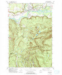
1993 Map of Sultan
USGS Topo · Published 1993About this map
Sultan occupies a strategic position at the confluence of the Sultan River and the Skykomish River, serving as a focal point for the logging and transportation corridors of the western Cascades. By the early 1990s, the landscape reflected a transition from industrial exploitation to recreational and residential use, evidenced by the presence of Centennial Park and several mobile home communities. The southern half of the map is defined by a complex network of upland lakes and ridges, including Lake Elsie, Dagger Lake, and the curiously named Drunken Charlie Lake. This area is crisscrossed by historic routes like the Old Railroad Grade and the Tolt Truck Trail, which highlight the region's history of timber extraction and transport. Further north, the Wallace River joins the Skykomish, framing a valley floor marked by a Landing Strip and gravel operations, while the High Sch and local Cem ground the community's civic identity.
Find a feature on this map
36 named features on this map. Tap any name to fly to it.
Don’t see what you’re looking for? This feature index may not catch every label — zoom into the map to look around manually.
Map Details
Editions of this 1993 Sultan Map
This is the sole edition of this map. No revisions or reprints were ever made.
Other maps of this area

1921 · Sultan
USGS Topo · 1:125,000

1923 · Sultan
USGS Topo · 1:125,000

1953 · Sultan
USGS Topo · 1:24,000

1953 · Lake Joy
USGS Topo · 1:24,000

1953 · Monroe
USGS Topo · 1:24,000

1953 · Carnation
USGS Topo · 1:24,000

1956 · Monroe
USGS Topo · 1:62,500

1957 · Index
USGS Topo · 1:62,500

1957 · Wenatchee
USGS Topo · 1:250,000

1960 · Mount Si
USGS Topo · 1:62,500