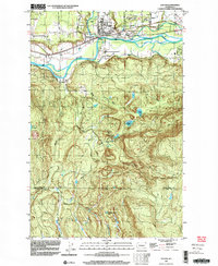
1997 Map of Sultan
USGS Topo · Published 2003About this map
The Sultan townsite sits at the strategic confluence where the Sultan River and Wallace River join the Skykomish River. By the late 1990s, this area reflects a landscape shaped by both active industry and rural expansion, featuring numerous Borrow Pits and Gravel Pits alongside residential additions like the Mobile Home Park. The Burlington Northern line parallels the river, maintaining the corridor's long-standing role as a transportation artery through the foothills.
Find a feature on this map
36 named features on this map. Tap any name to fly to it.
Don’t see what you’re looking for? This feature index may not catch every label — zoom into the map to look around manually.
Map Details
Editions of this 1997 Sultan Map
This is the sole edition of this map. No revisions or reprints were ever made.
Other maps of this area

1921 · Sultan
USGS Topo · 1:125,000

1923 · Sultan
USGS Topo · 1:125,000

1953 · Sultan
USGS Topo · 1:24,000

1953 · Lake Joy
USGS Topo · 1:24,000

1953 · Monroe
USGS Topo · 1:24,000

1953 · Carnation
USGS Topo · 1:24,000

1956 · Monroe
USGS Topo · 1:62,500

1957 · Index
USGS Topo · 1:62,500

1957 · Wenatchee
USGS Topo · 1:250,000

1960 · Mount Si
USGS Topo · 1:62,500