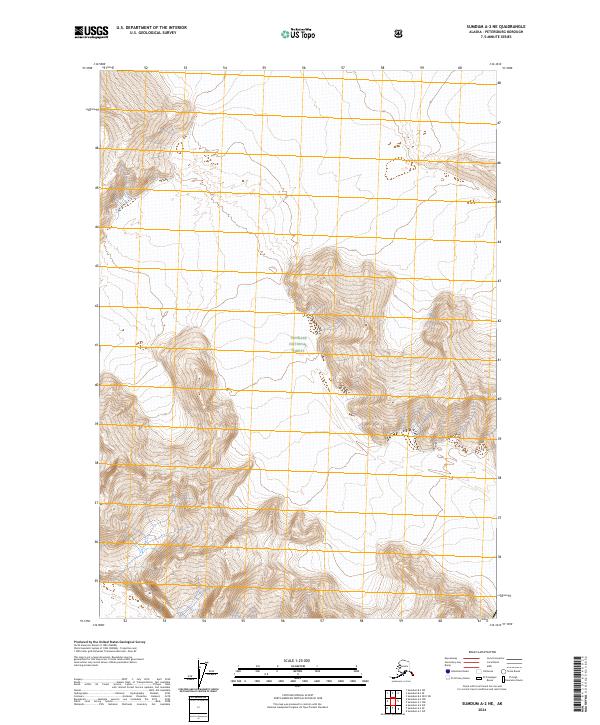
2024 Map of Sumdum A-2 NE
USGS Topo · Published 2024About this map
Tongass National Forest dominates the landscape in this portion of the Petersburg Borough. The map portrays a remote and dramatic expanse of Southeast Alaska, defined by steep elevational shifts and a complex network of ridgelines and peaks. The absence of roads or developed settlements highlights the wild character of this region, which remains largely under the administration of the United States Forest Service. Because the survey is part of the modern 7.5-minute series, it provides high-resolution contour data that helps visualize the intricate drainages and sharp terrain that characterize the coastal mountains. Researchers studying the topography of the Alaska Panhandle will find the detailed contours and public land survey system lines, such as t54s r82e, essential for pinpointing specific geographic coordinates within this roadless wilderness.
Find a feature on this map
7 named features on this map. Tap any name to fly to it.
Don’t see what you’re looking for? This feature index may not catch every label — zoom into the map to look around manually.
Map Details
Editions of this 2024 Sumdum A-2 NE Map
This is the sole edition of this map. No revisions or reprints were ever made.
Other maps of this area

1952 · Sumdum
USGS Topo · 1:250,000

1960 · Sumdum A-1
USGS Topo · 1:63,360

1961 · Sumdum A-2
USGS Topo · 1:63,360

1961 · Sumdum B-2
USGS Topo · 1:63,360

1961 · Sumdum
USGS Topo · 1:250,000

2000 · Sumdum A-2
USGS Topo · 1:63,360

2000 · Sumdum B-2
USGS Topo · 1:63,360
2018 · Sumdum B-2 SW
USGS Topo · 1:25,000
2018 · Sumdum A-1 NW
USGS Topo · 1:25,000
2018 · Sumdum A-2 NE
USGS Topo · 1:25,000