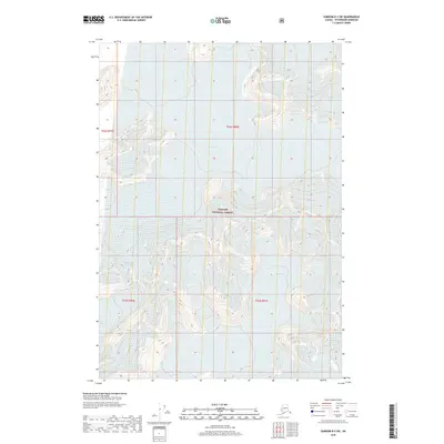
2018 Map of Sumdum B-2 SW
USGS Topo · Published 2018About this map
Tongass National Forest dominates this section of the Petersburg Borough, where the movement of massive ice fields defines the landscape. The intricate topography of the region is punctuated by the presence of Dawes Glacier and the expansive Baird Glacier, including its northern tributary, North Baird Glacier. This 2018 survey documents a remote and dynamic glacial environment, recording the contemporary margins of the ice as it flows through these coastal mountains. The map also features the smaller Oasis Glacier, illustrating the complex network of alpine ice and rock that characterizes this high-latitude wilderness. For those studying the environmental shifts of the Alaskan panhandle, this record provides a precise look at the intersection of protected forest lands and active glacial systems.
Find a feature on this map
9 named features on this map. Tap any name to fly to it.
Don’t see what you’re looking for? This feature index may not catch every label — zoom into the map to look around manually.
Map Details
Editions of this 2018 Sumdum B-2 SW Map
This is the sole edition of this map. No revisions or reprints were ever made.
Other maps of this area

1952 · Sumdum
USGS Topo · 1:250,000

1961 · Sumdum A-2
USGS Topo · 1:63,360

1961 · Sumdum B-2
USGS Topo · 1:63,360

1961 · Sumdum A-3
USGS Topo · 1:63,360

1961 · Sumdum B-3
USGS Topo · 1:63,360

1961 · Sumdum
USGS Topo · 1:250,000

1996 · Sumdum B-3
USGS Topo · 1:63,360

2000 · Sumdum A-2
USGS Topo · 1:63,360

2000 · Sumdum B-2
USGS Topo · 1:63,360
2018 · Sumdum A-2 NE
USGS Topo · 1:25,000