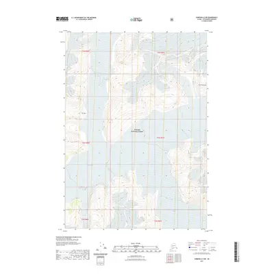
2021 Map of Sumdum A-2 NW
USGS Topo · Published 2021About this map
Tongass National Forest dominates this section of the Coast Mountains, where ice and rock define the landscape in the early 21st century. The topographic survey documents the massive expanse of the Baird Glacier alongside the smaller Witch Glacier, providing a detailed record of glacial extent and elevation during this period. A notable terrestrial landmark known as The Oasis sits surrounded by the complex contour lines of this high-altitude environment, offering a specific point of reference within the broader wilderness. This 2021 update utilizes modern elevation data and imagery to chart the shifting boundaries of the ice fields in one of the most remote corridors of the Alaska panhandle.
Find a feature on this map
11 named features on this map. Tap any name to fly to it.
Don’t see what you’re looking for? This feature index may not catch every label — zoom into the map to look around manually.
Map Details
Editions of this 2021 Sumdum A-2 NW Map
This is the sole edition of this map. No revisions or reprints were ever made.
Other maps of this area

1952 · Sumdum
USGS Topo · 1:250,000

1961 · Sumdum A-2
USGS Topo · 1:63,360

1961 · Sumdum B-2
USGS Topo · 1:63,360

1961 · Sumdum A-3
USGS Topo · 1:63,360

1961 · Sumdum B-3
USGS Topo · 1:63,360

1961 · Sumdum
USGS Topo · 1:250,000

1996 · Sumdum B-3
USGS Topo · 1:63,360

2000 · Sumdum A-2
USGS Topo · 1:63,360

2000 · Sumdum B-2
USGS Topo · 1:63,360
2018 · Sumdum B-2 SW
USGS Topo · 1:25,000