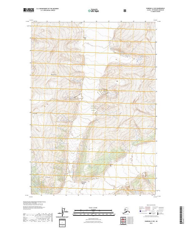
2024 Map of Sumdum A-3 NE
USGS Topo · Published 2024About this map
Tongass National Forest encompasses the entirety of this coastal Alaskan landscape, where the high elevations of the Buddington Range meet dramatic alpine peaks. The terrain is defined by a dense network of contour lines indicating steep relief, characteristic of the Petersburg Borough wilderness. Notable high points like Agassiz Peak and Dome Peak provide orientation markers within the expansive forest boundaries. South of these summits, Hump Knoll stands as a distinct landmark above the drainage systems. This 2024 data reflects the modern topographical state of the region, emphasizing the natural barriers and elevation changes that dictate travel and land use within these protected federal lands.
Find a feature on this map
11 named features on this map. Tap any name to fly to it.
Don’t see what you’re looking for? This feature index may not catch every label — zoom into the map to look around manually.
Map Details
Editions of this 2024 Sumdum A-3 NE Map
This is the sole edition of this map. No revisions or reprints were ever made.
Other maps of this area

1952 · Sumdum
USGS Topo · 1:250,000

1961 · Sumdum A-2
USGS Topo · 1:63,360

1961 · Sumdum B-2
USGS Topo · 1:63,360

1961 · Sumdum A-3
USGS Topo · 1:63,360

1961 · Sumdum B-3
USGS Topo · 1:63,360

1961 · Sumdum
USGS Topo · 1:250,000

1996 · Sumdum B-3
USGS Topo · 1:63,360

2000 · Sumdum A-2
USGS Topo · 1:63,360

2000 · Sumdum B-2
USGS Topo · 1:63,360
2018 · Sumdum B-2 SW
USGS Topo · 1:25,000