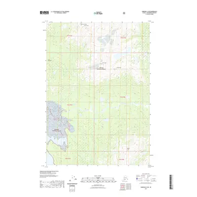
2021 Map of Sumdum A-4 NE
USGS Topo · Published 2021About this map
Farragut River winds through the heart of this coastal wilderness within the Tongass National Forest, illustrating the complex drainage patterns of the Coast Mountains in Southeast Alaska. The landscape is dominated by high-altitude summits, including the prominent Lincoln Peak in the American Range and the distinctive Grant Peak. These peaks are punctuated by glacial features and permanent ice fields that define the upper reaches of the river's watershed. Topographic detail shows the dramatic verticality of the terrain between Stanton Peak and the Franklin Peaks, capturing a largely roadless area where the natural hydrography and elevation contours dictate the movement of water and any potential foot travel through the dense forest and alpine zones.
Find a feature on this map
14 named features on this map. Tap any name to fly to it.
Don’t see what you’re looking for? This feature index may not catch every label — zoom into the map to look around manually.
Map Details
Editions of this 2021 Sumdum A-4 NE Map
This is the sole edition of this map. No revisions or reprints were ever made.
Other maps of this area

1943 · Sumdum B-4
USGS Topo · 1:63,360

1948 · Sumdum A-4
USGS Topo · 1:63,360

1948 · Sumdum B-4
USGS Topo · 1:63,360

1951 · Sumdum A-4
USGS Topo · 1:63,360

1952 · Sumdum
USGS Topo · 1:250,000

1961 · Sumdum A-3
USGS Topo · 1:63,360

1961 · Sumdum B-3
USGS Topo · 1:63,360

1961 · Sumdum
USGS Topo · 1:250,000

1996 · Sumdum B-3
USGS Topo · 1:63,360

1996 · Sumdum B-4
USGS Topo · 1:63,360