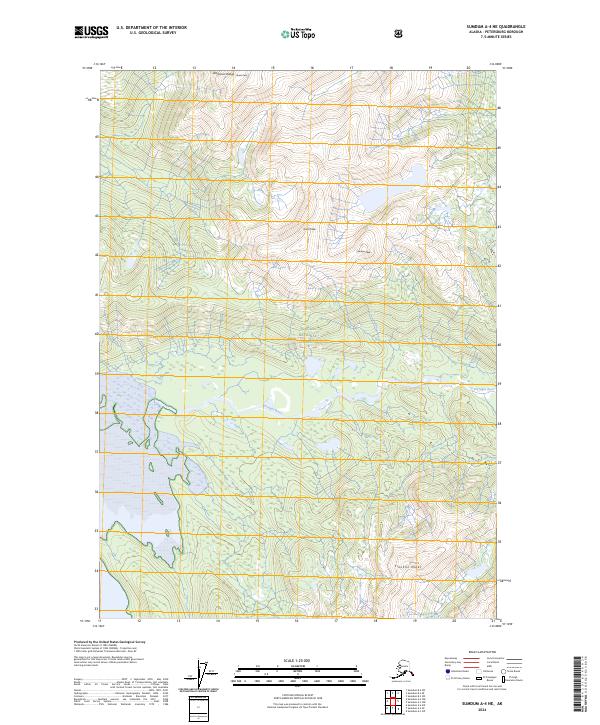
2024 Map of Sumdum A-4 NE
USGS Topo · Published 2024About this map
The Farragut River winds through the heart of this coastal wilderness, carving a path through the steep terrain of the Tongass National Forest. This modern 2024 survey documents the complex topography of the American Range, where high elevations are defined by prominent landmarks such as Lincoln Peak, Grant Peak, and Stanton Peak. The landscape is dominated by dense forest cover and high-altitude peaks, including the southern Franklin Peaks, showing an environment where natural waterways and vertical relief dictate the geography. The absence of roads or permanent settlements highlights the protected status of these lands, preserving a snapshot of the region's character within the contemporary National Map framework.
Find a feature on this map
13 named features on this map. Tap any name to fly to it.
Don’t see what you’re looking for? This feature index may not catch every label — zoom into the map to look around manually.
Map Details
Editions of this 2024 Sumdum A-4 NE Map
This is the sole edition of this map. No revisions or reprints were ever made.
Other maps of this area

1943 · Sumdum B-4
USGS Topo · 1:63,360

1948 · Sumdum A-4
USGS Topo · 1:63,360

1948 · Sumdum B-4
USGS Topo · 1:63,360

1951 · Sumdum A-4
USGS Topo · 1:63,360

1952 · Sumdum
USGS Topo · 1:250,000

1961 · Sumdum A-3
USGS Topo · 1:63,360

1961 · Sumdum B-3
USGS Topo · 1:63,360

1961 · Sumdum
USGS Topo · 1:250,000

1996 · Sumdum B-3
USGS Topo · 1:63,360

1996 · Sumdum B-4
USGS Topo · 1:63,360