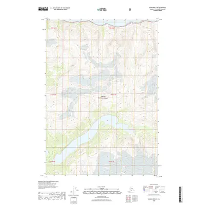
2018 Map of Sumdum B-3 NW
USGS Topo · Published 2018About this map
Tongass National Forest encompasses the vast majority of this landscape in the Alaska panhandle, where steep glacial topography meets the saltwater of Endicott Arm. This 2018 survey reveals a terrain defined by ice and elevation, with contours climbing rapidly from the shoreline into the high peaks of the Coast Mountains. The map provides a precise record of the shoreline of Endicott Arm, a deep fjord that serves as a primary waterway for this coastal wilderness. Sparse in human-named landmarks but rich in environmental detail, the sheet documents the intricate drainage patterns and glacial formations characteristic of this remote portion of the Tongass National Forest near the Petersburg Borough. It serves as a modern baseline for understanding the glacial recession and coastline of this specific fjord system within the unorganized borough.
Find a feature on this map
8 named features on this map. Tap any name to fly to it.
Don’t see what you’re looking for? This feature index may not catch every label — zoom into the map to look around manually.
Map Details
Editions of this 2018 Sumdum B-3 NW Map
This is the sole edition of this map. No revisions or reprints were ever made.
Other maps of this area

1943 · Sumdum B-4
USGS Topo · 1:63,360

1948 · Sumdum B-4
USGS Topo · 1:63,360

1952 · Sumdum
USGS Topo · 1:250,000

1961 · Sumdum C-3
USGS Topo · 1:63,360

1961 · Sumdum C-4
USGS Topo · 1:63,360

1961 · Sumdum B-3
USGS Topo · 1:63,360

1961 · Sumdum
USGS Topo · 1:250,000

1996 · Sumdum B-3
USGS Topo · 1:63,360

1996 · Sumdum B-4
USGS Topo · 1:63,360

2000 · Sumdum C-3
USGS Topo · 1:63,360