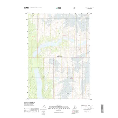
2021 Map of Sumdum B-3 SW
USGS Topo · Published 2021About this map
Glory Lake dominates the upper reaches of this coastal wilderness within the Tongass National Forest, illustrating a landscape defined by significant elevation changes and glacial hydrology. The drainage system is anchored by the Farragut River, which flows south toward Farragut Lake, carving through the steep topography of the Petersburg Borough. High-altitude landmarks like Maury Peak provide fixed points of reference amidst the dense contour lines, marking the sharp relief typical of the Alaskan panhandle. This 2021 survey utilizes high-resolution SPOT imagery to document the precise shoreline of these remote water bodies and the intricate wetland patterns along the river corridor, offering a clear view of the region's natural state in the early 21st century.
Find a feature on this map
9 named features on this map. Tap any name to fly to it.
Don’t see what you’re looking for? This feature index may not catch every label — zoom into the map to look around manually.
Map Details
Editions of this 2021 Sumdum B-3 SW Map
This is the sole edition of this map. No revisions or reprints were ever made.
Other maps of this area

1943 · Sumdum B-4
USGS Topo · 1:63,360

1948 · Sumdum A-4
USGS Topo · 1:63,360

1948 · Sumdum B-4
USGS Topo · 1:63,360

1951 · Sumdum A-4
USGS Topo · 1:63,360

1952 · Sumdum
USGS Topo · 1:250,000

1961 · Sumdum A-3
USGS Topo · 1:63,360

1961 · Sumdum B-3
USGS Topo · 1:63,360

1961 · Sumdum
USGS Topo · 1:250,000

1996 · Sumdum B-3
USGS Topo · 1:63,360

1996 · Sumdum B-4
USGS Topo · 1:63,360