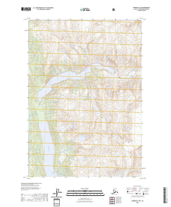
2024 Map of Sumdum B-3 SW
USGS Topo · Published 2024About this map
Tracy Arm-Fords Terror Wilderness and the Tongass National Forest dominate this coastal Alaskan landscape, where glacial waters and high elevations define the terrain. The Farragut River winds through the central valley, connecting the high-altitude Glory Lake to the lower reaches of the drainage system. Near the southern boundary, Farragut Lake sits beneath the shadow of Maury Peak, illustrating the dramatic relief of the Coast Mountains. This topography reflects a wilderness largely untouched by permanent settlement, where natural waterways serve as the primary corridors through the dense forest and steep rock faces of the Southeast Alaska panhandle.
Find a feature on this map
10 named features on this map. Tap any name to fly to it.
Don’t see what you’re looking for? This feature index may not catch every label — zoom into the map to look around manually.
Map Details
Editions of this 2024 Sumdum B-3 SW Map
This is the sole edition of this map. No revisions or reprints were ever made.
Other maps of this area

1943 · Sumdum B-4
USGS Topo · 1:63,360

1948 · Sumdum A-4
USGS Topo · 1:63,360

1948 · Sumdum B-4
USGS Topo · 1:63,360

1951 · Sumdum A-4
USGS Topo · 1:63,360

1952 · Sumdum
USGS Topo · 1:250,000

1961 · Sumdum A-3
USGS Topo · 1:63,360

1961 · Sumdum B-3
USGS Topo · 1:63,360

1961 · Sumdum
USGS Topo · 1:250,000

1996 · Sumdum B-3
USGS Topo · 1:63,360

1996 · Sumdum B-4
USGS Topo · 1:63,360