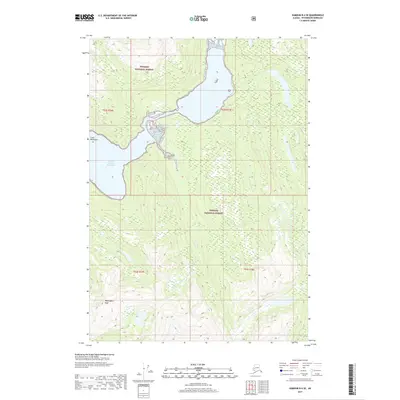
2017 Map of Sumdum B-4 SE
USGS Topo · Published 2017About this map
Tongass National Forest dominates this coastal Alaska terrain, where the saltwater of North Arm Port Houghton reaches deep into the glacial landscape of the Coast Mountains. This 2017 survey details a high-relief environment defined by sharp elevation changes, culminating in the prominent Washington Peak in the southwest. The map provides a precise view of the complex hydrology and forest boundaries within the Petersburg Borough, tracing the shoreline where tidal waters meet the mountain foothills. The absence of roads or permanent settlements underscores the wilderness character of the region, emphasizing the natural topography and the forest service management areas including t52s r76e and t53s r77e.
Find a feature on this map
8 named features on this map. Tap any name to fly to it.
Don’t see what you’re looking for? This feature index may not catch every label — zoom into the map to look around manually.
Map Details
Editions of this 2017 Sumdum B-4 SE Map
This is the sole edition of this map. No revisions or reprints were ever made.
Other maps of this area

1943 · Sumdum B-4
USGS Topo · 1:63,360

1948 · Sumdum A-4
USGS Topo · 1:63,360

1948 · Sumdum B-4
USGS Topo · 1:63,360

1951 · Sumdum A-4
USGS Topo · 1:63,360

1952 · Sumdum
USGS Topo · 1:250,000

1961 · Sumdum A-3
USGS Topo · 1:63,360

1961 · Sumdum B-3
USGS Topo · 1:63,360

1961 · Sumdum
USGS Topo · 1:250,000

1996 · Sumdum B-3
USGS Topo · 1:63,360

1996 · Sumdum B-4
USGS Topo · 1:63,360