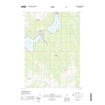
2021 Map of Sumdum B-4 SE
USGS Topo · Published 2021About this map
Tongass National Forest dominates this coastal landscape within the Coast Mountains, where the intricate intersection of glacial terrain and saltwater is on full display. The northernmost reaches of the North Arm Port Houghton penetrate the shoreline, creating a complex maritime boundary against steep interior elevations. High-altitude landmarks like Washington Peak anchor the southern portion of the quadrangle, which is defined by significant vertical relief and dense forest cover typical of the Petersburg Borough wilderness. The map provides precise topographic data for this uninhabited stretch of the Alaskan panhandle, detailing the drainage patterns and peaks that define the region's natural geography in the early twenty-first century.
Find a feature on this map
8 named features on this map. Tap any name to fly to it.
Don’t see what you’re looking for? This feature index may not catch every label — zoom into the map to look around manually.
Map Details
Editions of this 2021 Sumdum B-4 SE Map
This is the sole edition of this map. No revisions or reprints were ever made.
Other maps of this area

1943 · Sumdum B-4
USGS Topo · 1:63,360

1948 · Sumdum A-4
USGS Topo · 1:63,360

1948 · Sumdum B-4
USGS Topo · 1:63,360

1951 · Sumdum A-4
USGS Topo · 1:63,360

1952 · Sumdum
USGS Topo · 1:250,000

1961 · Sumdum A-3
USGS Topo · 1:63,360

1961 · Sumdum B-3
USGS Topo · 1:63,360

1961 · Sumdum
USGS Topo · 1:250,000

1996 · Sumdum B-3
USGS Topo · 1:63,360

1996 · Sumdum B-4
USGS Topo · 1:63,360