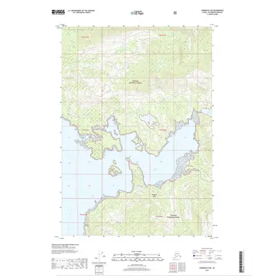
2017 Map of Sumdum B-5 NE
USGS Topo · Published 2017About this map
Hobart Bay dominates this coastal survey, where the saltwater environment of the Tongass National Forest meets the steep topography of Southeast Alaska. This 2017 study illustrates the intricate interface of land and sea, marked by significant navigational landmarks such as Entrance Island and Point Hobart. The tidal complexities of the region are evidenced by the presence of The Salt Chuck in the northeastern corner, a term often used in the Pacific Northwest for a saltwater body or lagoon affected by the tides. Freshwater drainage from the high inland terrain is channeled through systems like Libby Cr, which cuts through the dense forest before reaching the coastline. The map serves as a contemporary record of this largely undeveloped maritime landscape within the Petersburg Borough.
Find a feature on this map
12 named features on this map. Tap any name to fly to it.
Don’t see what you’re looking for? This feature index may not catch every label — zoom into the map to look around manually.
Map Details
Editions of this 2017 Sumdum B-5 NE Map
This is the sole edition of this map. No revisions or reprints were ever made.
Other maps of this area

1943 · Sumdum B-4
USGS Topo · 1:63,360

1948 · Sumdum C-5
USGS Topo · 1:63,360

1948 · Sumdum B-5
USGS Topo · 1:63,360

1948 · Sumdum B-4
USGS Topo · 1:63,360

1951 · Sumdum C-5
USGS Topo · 1:63,360

1951 · Sumdum B-5
USGS Topo · 1:63,360

1952 · Sumdum
USGS Topo · 1:250,000

1961 · Sumdum C-4
USGS Topo · 1:63,360

1961 · Sumdum
USGS Topo · 1:250,000

1996 · Sumdum B-4
USGS Topo · 1:63,360