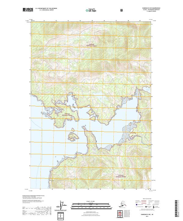
2021 Map of Sumdum B-5 NE
USGS Topo · Published 2021About this map
Hobart Bay dominates this coastal portion of the Tongass National Forest, showing the intricate shoreline where the wilderness meets the Alexander Archipelago. The maritime geography is defined by prominent landmarks such as Point Hobart and the sheltered waters of The Salt Chuck to the northeast. Small drainage systems like Libby Cr flow from high elevations through dense forest tracts, which are segmented by the Public Land Survey System grids of township and range lines. The presence of Entrance Island at the mouth of the bay provides a clear navigational marker for the maritime approaches. This 2021 update utilizes modern remote sensing to document the exact contours of the coastline and the wooded interior, serving as a baseline for understanding the unchanged character of this undeveloped coastal environment.
Find a feature on this map
13 named features on this map. Tap any name to fly to it.
Don’t see what you’re looking for? This feature index may not catch every label — zoom into the map to look around manually.
Map Details
Editions of this 2021 Sumdum B-5 NE Map
This is the sole edition of this map. No revisions or reprints were ever made.
Other maps of this area

1943 · Sumdum B-4
USGS Topo · 1:63,360

1948 · Sumdum C-5
USGS Topo · 1:63,360

1948 · Sumdum B-5
USGS Topo · 1:63,360

1948 · Sumdum B-4
USGS Topo · 1:63,360

1951 · Sumdum C-5
USGS Topo · 1:63,360

1951 · Sumdum B-5
USGS Topo · 1:63,360

1952 · Sumdum
USGS Topo · 1:250,000

1961 · Sumdum C-4
USGS Topo · 1:63,360

1961 · Sumdum
USGS Topo · 1:250,000

1996 · Sumdum B-4
USGS Topo · 1:63,360