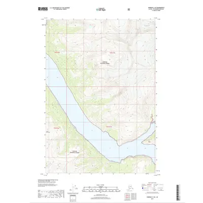
2017 Map of Sumdum C-4 SE
USGS Topo · Published 2017About this map
The Coast Mountains dominate this 2017 survey, where dramatic ice and saltwater meet in the heart of the Tongass National Forest. The landscape is defined by its deep maritime fjords and the descending ice of the North Dawes Glacier, which occupies the upper northeastern corner of the quadrangle. This map documents a wilderness landscape largely devoid of human infrastructure, focusing instead on the physical relationship between the mountain peaks and the tidal waters that reach into the interior. The topographic detail traces the steep elevation changes from sea level up into the high alpine zones of the Alaska Panhandle, providing a precise record of the shoreline and glacial extent as they appeared in the early 21st century.
Find a feature on this map
8 named features on this map. Tap any name to fly to it.
Don’t see what you’re looking for? This feature index may not catch every label — zoom into the map to look around manually.
Map Details
Editions of this 2017 Sumdum C-4 SE Map
This is the sole edition of this map. No revisions or reprints were ever made.
Other maps of this area

1943 · Sumdum B-4
USGS Topo · 1:63,360

1948 · Sumdum B-4
USGS Topo · 1:63,360

1952 · Sumdum
USGS Topo · 1:250,000

1961 · Sumdum C-3
USGS Topo · 1:63,360

1961 · Sumdum C-4
USGS Topo · 1:63,360

1961 · Sumdum B-3
USGS Topo · 1:63,360

1961 · Sumdum
USGS Topo · 1:250,000

1996 · Sumdum B-3
USGS Topo · 1:63,360

1996 · Sumdum B-4
USGS Topo · 1:63,360

2000 · Sumdum C-3
USGS Topo · 1:63,360