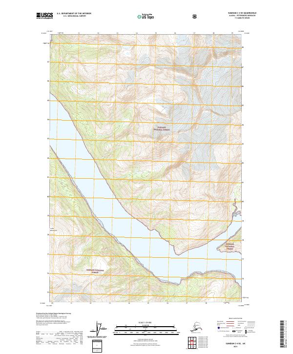
2021 Map of Sumdum C-4 SE
USGS Topo · Published 2021About this map
Tongass National Forest covers the majority of this coastal wilderness, where the high ridges of the Coast Mountains meet the tide-influenced waters of Southeast Alaska. This 2021 topographic record reveals a landscape dominated by dramatic elevation changes, rising from the shoreline to over 5,000 feet within just a few miles. The northern portion of the map is defined by the massive North Dawes Glacier, which serves as a critical point of study for glacial retreat and geological transformation. The map provides precise detail on the intersection of maritime and glacial environments, documenting the complex contours of the fjords and the vast protected lands managed by the forest service. For those studying the glaciology of the region, the placement and extent of the ice fields relative to the coastline offer significant insight-gain into the modern state of Alaska's wild interior.
Find a feature on this map
7 named features on this map. Tap any name to fly to it.
Don’t see what you’re looking for? This feature index may not catch every label — zoom into the map to look around manually.
Map Details
Editions of this 2021 Sumdum C-4 SE Map
This is the sole edition of this map. No revisions or reprints were ever made.
Other maps of this area

1943 · Sumdum B-4
USGS Topo · 1:63,360

1948 · Sumdum B-4
USGS Topo · 1:63,360

1952 · Sumdum
USGS Topo · 1:250,000

1961 · Sumdum C-3
USGS Topo · 1:63,360

1961 · Sumdum C-4
USGS Topo · 1:63,360

1961 · Sumdum B-3
USGS Topo · 1:63,360

1961 · Sumdum
USGS Topo · 1:250,000

1996 · Sumdum B-3
USGS Topo · 1:63,360

1996 · Sumdum B-4
USGS Topo · 1:63,360

2000 · Sumdum C-3
USGS Topo · 1:63,360