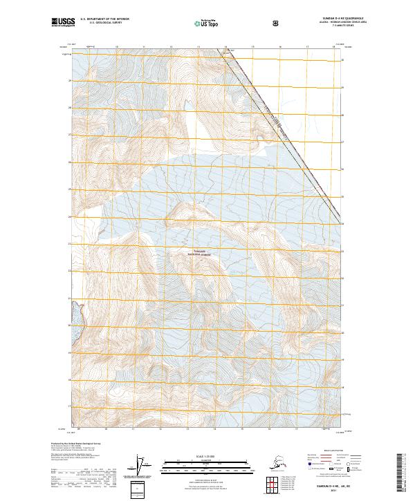
2021 Map of Sumdum D-4 NE
USGS Topo · Published 2021About this map
Sawyer Glacier dominates the central terrain of this high-latitude region within the Tongass National Forest. The landscape is defined by extreme elevations and glacial activity, with Mt Hill standing as a prominent landmark along the international boundary. This border, separating the United States and Canada, cuts diagonally across the northeastern corner of the map. The topography illustrates the complex relationship between maritime climate and ice-field geography, where steep mountain ridges give way to massive ice sheets and drainage basins. Surveyed in the early 21st century, the map details the precise alignment of the frontier and the extent of protected forest lands in this part of the Alaska Panhandle.
Find a feature on this map
8 named features on this map. Tap any name to fly to it.
Don’t see what you’re looking for? This feature index may not catch every label — zoom into the map to look around manually.
Map Details
Editions of this 2021 Sumdum D-4 NE Map
This is the sole edition of this map. No revisions or reprints were ever made.
Other maps of this area

1951 · Taku River A-4
USGS Topo · 1:63,360

1952 · Sumdum
USGS Topo · 1:250,000

1953 · Taku River
USGS Topo · 1:250,000

1960 · Taku River
USGS Topo · 1:250,000

1960 · Sumdum D-4
USGS Topo · 1:63,360

1961 · Sumdum D-3
USGS Topo · 1:63,360

1961 · Sumdum
USGS Topo · 1:250,000
1994 · Sumdum D-4
USGS Topo · 1:63,360
2017 · Sumdum D-4 SW
USGS Topo · 1:25,000
2017 · Sumdum D-4 SE
USGS Topo · 1:25,000