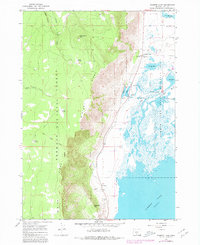
1966 Map of Summer Lake
USGS Topo · Published 1980About this map
Winter Ridge dominates the western landscape of this Lake County survey, creating a sharp escarpment that drops toward the marshlands and alkaline waters of Summer Lake. The 1966 field check records a delicate balance between the high timber of the Fremont National Forest and the wetland ecosystems of the Summer Lake State Wildlife Area. Cultural markers of early settlement are preserved in the topography, including the Old Indian Treaty Boundary cutting across the forest floor and the Ana River Sch near the small community of Summer Lake. The hydrology of the basin is well-documented, showing the flow from Ana Reservoir feeding the Ana River, alongside numerous springs like Bagley Spring and Bottle Spring that emerge from the base of the ridge. A local Grange Hall and the Headquarters for the wildlife area stand as central landmarks for this rural high-desert outpost.
Find a feature on this map
26 named features on this map. Tap any name to fly to it.
Don’t see what you’re looking for? This feature index may not catch every label — zoom into the map to look around manually.
Map Details
Editions of this 1966 Summer Lake Map
Other maps of this area

1955 · Crescent
USGS Topo · 1:250,000

1955 · Klamath Falls
USGS Topo · 1:250,000

1957 · Crescent
USGS Topo · 1:250,000

1958 · Crescent
USGS Topo · 1:250,000

1958 · Klamath Falls
USGS Topo · 1:250,000

1966 · Summer Lake
USGS Topo · 1:24,000

1966 · Fremont Point
USGS Topo · 1:24,000

1966 · Pole Butte
USGS Topo · 1:24,000

1966 · Foster Butte
USGS Topo · 1:24,000

1970 · Crescent
USGS Topo · 1:250,000