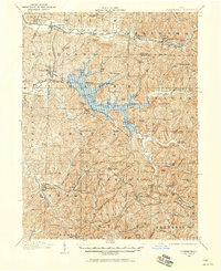
1909 Map of Summerfield
USGS Topo · Published 1958About this map
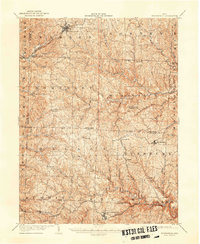
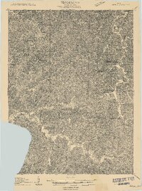
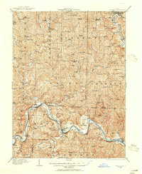
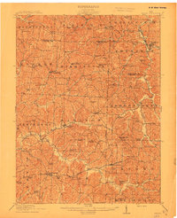
Military Lands and the dissected hill country of southeastern Ohio dominate this 1909 survey, revealing a landscape densely populated by rural communities and farmsteads. The Baltimore and Ohio railroad corridor anchors the northern edge, connecting Quaker City and Salesville to the wider region. The map highlights a significant network of rural social centers, including numerous schoolhouses like Wyscarver School and Denyer School, and local landmarks like the Infirmary near Sarahsville.
Find a feature on this map
118 named features on this map. Tap any name to fly to it.
Don’t see what you’re looking for? This feature index may not catch every label — zoom into the map to look around manually.
Map Details
Editions of this 1909 Summerfield Map
This is the sole edition of this map. No revisions or reprints were ever made.
Other maps of this area

1903 · Macksburg
USGS Topo · 1:62,500

1903 · Flushing
USGS Topo · 1:62,500

1905 · New Matamoras
USGS Topo · 1:62,500
1905 · Woodsfield
USGS Topo · 1:62,500

1905 · Flushing
USGS Topo · 1:62,500

1905 · Macksburg
USGS Topo · 1:62,500
1909 · Antrim
USGS Topo · 1:48,000
1909 · Caldwell
USGS Topo · 1:62,500

1909 · Cambridge
USGS Topo · 1:62,500
1911 · Antrim
USGS Topo · 1:62,500