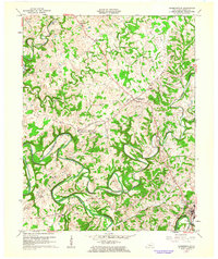
1961 Map of Summersville
USGS Topo · Published 1963About this map
The Green River and its winding tributaries, including Big Pitman Creek and Little Brush Creek, dominate this central Kentucky landscape. In the early 1960s, the area around Summersville and the county seat of Greensburg was characterized by a mix of small agricultural settlements and emerging mid-century infrastructure. Significant industrial footprints include a Hydrocarbon Recovery Plant near Gabe and various pipelines traversing the countryside, while a local Drive-in Theater and an Airstrip point to the recreational habits of the era. Genealogists will find a wealth of family-named cemeteries such as Vance Cem, Perkins Cem, and Milby Cem, alongside rural landmarks like Sand Lick Ch and Hodges Chapel. Geographically, the map highlights unique karst features like The Sinks of Little Brush and the tight river bend known as The Narrows, where the water wraps around a narrow limestone ridge.
Find a feature on this map
44 named features on this map. Tap any name to fly to it.
Don’t see what you’re looking for? This feature index may not catch every label — zoom into the map to look around manually.
Map Details
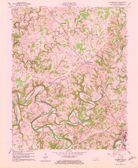
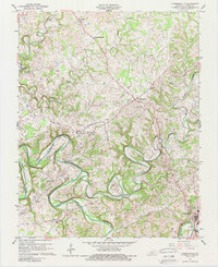
Editions of this 1961 Summersville Map
Other maps of this area

1953 · Saloma
USGS Topo · 1:24,000

1953 · Hudgins
USGS Topo · 1:24,000

1953 · Hibernia
USGS Topo · 1:24,000

1953 · Summersville
USGS Topo · 1:24,000

1953 · Exie
USGS Topo · 1:24,000

1953 · Magnolia
USGS Topo · 1:24,000

1953 · Gresham
USGS Topo · 1:24,000

1953 · Center
USGS Topo · 1:24,000

1954 · Greensburg
USGS Topo · 1:24,000

1957 · Winchester
USGS Topo · 1:250,000