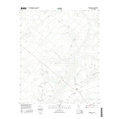
2017 Map of Summerville NW
USGS Topo · Published 2017About this map
Ashley River headwaters and a intricate network of swampy basins define the landscape of Berkeley County in this 2017 survey. The region is characterized by unique Carolina Bay features such as Pigeon Bay, Mosquito Bay, and Caton Bay, which sit alongside the extensive Wassamassaw Swamp. For local historians and genealogists, the map identifies several significant burial grounds, including Lebanon Cem, Rudd Cem, and the Wassamassaw Cem, providing a detailed look at the rural settlement patterns near Long Ridge. The drainage system is heavily articulated through numerous small waterways like Sandy Run, Caton Cr, and Black Cr, illustrating the low-lying coastal plain environment. Human presence is marked by a dense web of local roads, including Mudville Rd and Calamus Pond Rd, which connect these dispersed rural landmarks and water bodies.
Find a feature on this map
58 named features on this map. Tap any name to fly to it.
Don’t see what you’re looking for? This feature index may not catch every label — zoom into the map to look around manually.
Map Details
Editions of this 2017 Summerville NW Map
This is the sole edition of this map. No revisions or reprints were ever made.
Other maps of this area

1919 · Summerville
USGS Topo · 1:48,000

1919 · Ridgeville
USGS Topo · 1:48,000

1920 · Eutawville
USGS Topo · 1:48,000

1920 · Chicora
USGS Topo · 1:48,000

1920 · Ridgeville
USGS Topo · 1:62,500

1920 · Summerville
USGS Topo · 1:62,500

1921 · Chicora
USGS Topo · 1:62,500

1921 · Eutawville
USGS Topo · 1:62,500

1943 · Chicora
USGS Topo · 1:62,500

1943 · Ridgeville
USGS Topo · 1:62,500