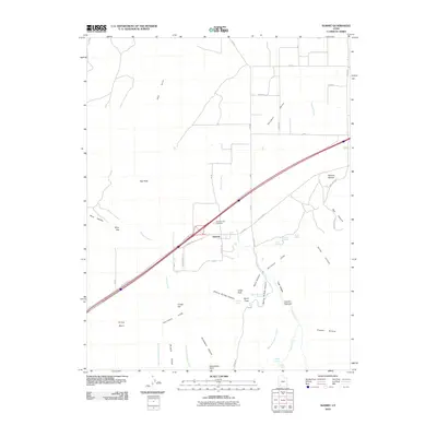
2010 Map of Summit
USGS Topo · Published 2010About this map
Summit sits at a geographic crossroads in southwestern Utah, where the floor of the Parowan Valley meets the dramatic rising front of the Hurricane Cliffs. This 2010 survey illustrates a landscape defined by sharp transitions between agricultural valley land and the steep, complex drainage systems of the plateau. The settlement is anchored by local landmarks such as the Summit City Cemetery and is flanked by a series of prominent summits including Red Peak, Spirit Peak, and Cedar Peak.
Find a feature on this map
51 named features on this map. Tap any name to fly to it.
Don’t see what you’re looking for? This feature index may not catch every label — zoom into the map to look around manually.
Map Details
Editions of this 2010 Summit Map
This is the sole edition of this map. No revisions or reprints were ever made.
Other maps of this area

1885 · St. George
USGS Topo · 1:250,000

1886 · Kanab
USGS Topo · 1:250,000

1891 · St. George
USGS Topo · 1:250,000

1950 · Enoch
USGS Topo · 1:24,000

1950 · Cedar City
USGS Topo · 1:24,000

1950 · Enoch
USGS Topo · 1:62,500

1950 · Cedar City
USGS Topo · 1:62,500

1950 · Enoch NE
USGS Topo · 1:24,000

1952 · Enoch NE
USGS Topo · 1:24,000

1953 · Cedar City
USGS Topo · 1:250,000