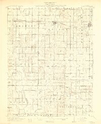
1913 Map of Sumner
USGS Topo · Published 1913About this map
The Baltimore and Ohio Southwestern RR serves as the central artery for this Illinois prairie region, connecting the primary settlements of Sumner and Bridgeport. This pre-World War I landscape reveals a dense network of country schools, such as Hickory Point School and Frogeye School, spaced frequently across the rural townships of Claremont and Lukin. The mapping by Frank Tweedy and his team illustrates how human settlement followed the drainage patterns of Muddy Creek and Bonpas Creek, with small villages like Berryville and Ruark serving as local hubs.
Find a feature on this map
80 named features on this map. Tap any name to fly to it.
Don’t see what you’re looking for? This feature index may not catch every label — zoom into the map to look around manually.
Map Details
Editions of this 1913 Sumner Map
2 editions found
Other maps of this area

1901 · Princeton
USGS Topo · 1:62,500

1903 · Princeton
USGS Topo · 1:62,500

1903 · Patoka
USGS Topo · 1:125,000

1904 · Mount Carmel
USGS Topo · 1:62,500

1910 · Hardinville
USGS Topo · 1:62,500

1911 · Sumner
USGS Topo · 1:62,500

1913 · Sumner
USGS Topo · 1:62,500

1915 · Vincennes
USGS Topo · 1:62,500

1917 · Birds
USGS Topo · 1:62,500

1941 · Newton
USGS Topo · 1:62,500