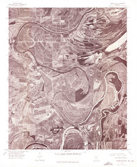
1974 Map of Sumner NE
USGS Topo · Published 1975About this map
Cassidy Bayou dominates the landscape of this portion of Tallahatchie County, winding in dramatic oxbows and meanders across the Mississippi Delta. Captured via aerial photography in the mid-1970s, the terrain reveals an intricate pattern of agricultural land use that follows the ancient alluvial deposits of the river system. The neighboring towns of Sumner and Webb are situated along these natural waterways, their street grids and structures visible against the sweep of the surrounding fields. This orthophotograph provides a clear look at the relationship between the delta's hydraulic history and the development of these rural Mississippi settlements, showing how the tight bends of the bayou influenced the placement of roads and homesteads.
Find a feature on this map
3 named features on this map. Tap any name to fly to it.
Don’t see what you’re looking for? This feature index may not catch every label — zoom into the map to look around manually.
Map Details
Editions of this 1974 Sumner NE Map
This is the sole edition of this map. No revisions or reprints were ever made.
Other maps of this area

1931 · Sumner
USGS Topo · 1:48,000

1932 · Philipp
USGS Topo · 1:48,000

1932 · Tutwiler
USGS Topo · 1:48,000

1935 · Crowder
USGS Topo · 1:62,500

1935 · Sumner
USGS Topo · 1:62,500

1935 · Tutwiler
USGS Topo · 1:62,500

1935 · Philipp
USGS Topo · 1:62,500

1939 · Sumner
USGS Topo · 1:62,500

1939 · Crowder
USGS Topo · 1:62,500

1939 · Philipp
USGS Topo · 1:62,500