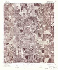
1974 Map of Sumner SW
USGS Topo · Published 1975About this map
Quiver River meanders across this alluvial landscape, its winding course defining the agricultural patterns of the Mississippi Delta in the mid-1970s. This orthophotoquad provides an unfiltered photographic record of the land surface, revealing the intricate oxbow scars and former river channels that have been integrated into a massive grid of cultivated fields. The absence of traditional cartographic symbols allows for a direct study of the terrain, where dark patches of timber remain clustered along the waterway and around the area known as Brooks. The drainage patterns and field boundaries captured here reflect the intensive land use and hydraulic management characteristic of Sunflower County, serving as a primary source for understanding the physical state of these rural tracts before later decades of further consolidation.
Find a feature on this map
2 named features on this map. Tap any name to fly to it.
Don’t see what you’re looking for? This feature index may not catch every label — zoom into the map to look around manually.
Map Details
Editions of this 1974 Sumner SW Map
This is the sole edition of this map. No revisions or reprints were ever made.
Other maps of this area

1931 · Schlater
USGS Topo · 1:48,000

1931 · Sumner
USGS Topo · 1:48,000

1931 · Drew
USGS Topo · 1:48,000

1934 · Cleveland
USGS Topo · 1:62,500

1934 · Schlater
USGS Topo · 1:62,500

1935 · Sumner
USGS Topo · 1:62,500

1935 · Mound Bayou
USGS Topo · 1:62,500

1939 · Schlater
USGS Topo · 1:62,500

1939 · Sumner
USGS Topo · 1:62,500

1940 · Cleveland
USGS Topo · 1:62,500