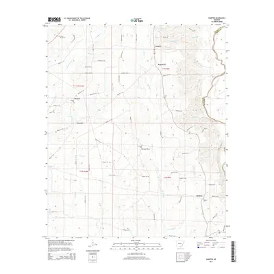
2014 Map of Sumpter
USGS Topo · Published 2014About this map
Sumpter and the small hamlets of Mannstown and Simpson define the rural landscape of Bradley County in this detailed survey. The area is characterized by a series of small, winding tributaries such as Snake Cr and Little Snake Cr that feed into the larger Saline River along the eastern border. This drainage pattern shaped the early settlement of the region, as evidenced by the distribution of family and community landmarks like Pattsville and Smearny. Genealogists will find particular value in the documentation of local burial grounds, including Hickory Springs Cem, Mt Olive Cem, and the Smearny Cem. The network of local routes like Bradley 33 Rd and Bradley 122 Rd provides a clear view of the rural infrastructure connecting these timber and agricultural communities near the Drew County line.
Find a feature on this map
63 named features on this map. Tap any name to fly to it.
Don’t see what you’re looking for? This feature index may not catch every label — zoom into the map to look around manually.
Map Details
Editions of this 2014 Sumpter Map
This is the sole edition of this map. No revisions or reprints were ever made.
Other maps of this area

1934 · Ingalls
USGS Topo · 1:48,000

1937 · Ingalls
USGS Topo · 1:62,500

1939 · Ingalls
USGS Topo · 1:62,500

1953 · Greenwood
USGS Topo · 1:250,000

1953 · El Dorado
USGS Topo · 1:250,000

1956 · Greenwood
USGS Topo · 1:250,000

1957 · El Dorado
USGS Topo · 1:250,000

1958 · El Dorado
USGS Topo · 1:250,000

1960 · El Dorado
USGS Topo · 1:250,000
1971 · Vick
USGS Topo · 1:24,000