
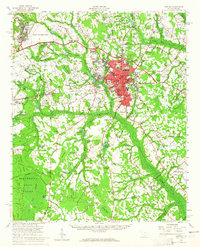
1957 Map of Sumter
USGS Topo · Published 1959About this map
The city of Sumter serves as the central hub of this mid-century landscape, characterized by its dense grid of schools including Lincoln High Sch, Edmunds High Sch, and Savage Glover Sch. Northwest of the city, the presence of Shaw Air Force Base and the Sumter Municipal Airport highlights the region's strategic importance during the Cold War. The surrounding countryside reveals a complex network of blackwater streams and swamps like Cane Savannah Br and Suicide Br, dotted with numerous community anchors such as Mt Zion Ch and Bold Pilgrim Ch. To the southwest, the Manchester State Forest and the State Forest Nursery occupy the sandy elevations of the Sand Hills, while the Atlantic Coast Line railroad facilitates transport through rural junctions like Privateer and Dinkins.
Find a feature on this map
131 named features on this map. Tap any name to fly to it.
Don’t see what you’re looking for? This feature index may not catch every label — zoom into the map to look around manually.
Map Details
Editions of this 1957 Sumter Map
2 editions found
Other maps of this area

1920 · Mayesville
USGS Topo · 1:48,000

1920 · Manning
USGS Topo · 1:48,000

1921 · Manning
USGS Topo · 1:62,500

1921 · Mayesville
USGS Topo · 1:62,500

1938 · Hagood
USGS Topo · 1:62,500

1941 · Spartanburg
USGS Topo · 1:250,000

1942 · Camden
USGS Topo · 1:125,000

1943 · Mayesville
USGS Topo · 1:62,500

1943 · Eastover
USGS Topo · 1:62,500

1944 · Manning
USGS Topo · 1:62,500