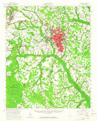
1957 Map of Sumter
USGS Topo · Published 1965About this map
Sumter serves as a thriving hub of education and aviation in the late 1950s, anchored by Morris College and a dense network of local schools including Edmunds High Sch and Lincoln High Sch. The urban center is surrounded by residential developments like Bon Air Terrace and Heathley Wood, while the massive footprint of Shaw Air Force Base dominates the northwest. Beyond the city limits, the landscape transitions into the wetlands and timberlands of the Manchester State Forest.
Find a feature on this map
118 named features on this map. Tap any name to fly to it.
Don’t see what you’re looking for? This feature index may not catch every label — zoom into the map to look around manually.
Map Details
Editions of this 1957 Sumter Map
2 editions found

Other maps of this area

1920 · Mayesville
USGS Topo · 1:48,000

1920 · Manning
USGS Topo · 1:48,000

1921 · Manning
USGS Topo · 1:62,500

1921 · Mayesville
USGS Topo · 1:62,500

1938 · Hagood
USGS Topo · 1:62,500

1941 · Spartanburg
USGS Topo · 1:250,000

1942 · Camden
USGS Topo · 1:125,000

1943 · Mayesville
USGS Topo · 1:62,500

1943 · Eastover
USGS Topo · 1:62,500

1944 · Manning
USGS Topo · 1:62,500