
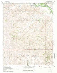
1968 Map of Sun City SW
USGS Topo · Published 1969About this map
The Medicine Lodge River carves through the northern reaches of this Barber County landscape, accompanied by the established route of the Atchison Topeka and Santa Fe railroad. This late-1960s survey documents a region defined by its energy and mineral extraction, notably the Sun City Oil and Gas Field and the Donald Oil and Gas Field. The map reveals the industrial footprint of the era through specific markers like Air Shafts, a Quarry, and multiple gravel pits that speak to the local economy beyond agriculture.
Find a feature on this map
24 named features on this map. Tap any name to fly to it.
Don’t see what you’re looking for? This feature index may not catch every label — zoom into the map to look around manually.
Map Details
Editions of this 1968 Sun City SW Map
2 editions found
Other maps of this area

1891 · Medicine Lodge
USGS Topo · 1:125,000

1892 · Coldwater
USGS Topo · 1:125,000

1893 · Medicine Lodge
USGS Topo · 1:125,000

1955 · Pratt
USGS Topo · 1:250,000

1959 · Pratt
USGS Topo · 1:250,000
1968 · Sun City
USGS Topo · 1:24,000

1968 · Wilmore SE
USGS Topo · 1:24,000

1968 · Belvidere
USGS Topo · 1:24,000
1973 · Sun City NE
USGS Topo · 1:24,000
1973 · Pump Creek
USGS Topo · 1:24,000