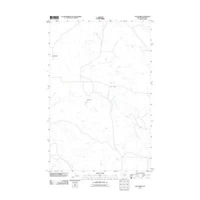
2011 Map of Sun Prairie
USGS Topo · Published 2011About this map
Sun Prairie Rd cuts through the high plains of Phillips County, anchoring this northern Montana landscape defined by its vital water drainage networks. The settlement of Sun Prairie sits along the western edge of the quadrangle, serving as a remote outpost in a region where local hydrology dictates the pattern of life and land use. Several significant watercourses, including Dog Creek and Telegraph Creek, carve through the terrain, illustrating the natural runoff paths that characterize this part of the state.
Find a feature on this map
7 named features on this map. Tap any name to fly to it.
Don’t see what you’re looking for? This feature index may not catch every label — zoom into the map to look around manually.
Map Details
Editions of this 2011 Sun Prairie Map
This is the sole edition of this map. No revisions or reprints were ever made.
Other maps of this area

1954 · Jordan
USGS Topo · 1:250,000

1956 · Jordan
USGS Topo · 1:250,000

1958 · Jordan
USGS Topo · 1:250,000

1964 · Jordan
USGS Topo · 1:250,000

1965 · Coal Mine Hill
USGS Topo · 1:24,000

1965 · Sun Prairie
USGS Topo · 1:24,000

1965 · Herman Point
USGS Topo · 1:24,000

1965 · Whitcomb Lake
USGS Topo · 1:24,000
1965 · Stratton Reservoir
USGS Topo · 1:24,000

1965 · Schuyler Butte
USGS Topo · 1:24,000