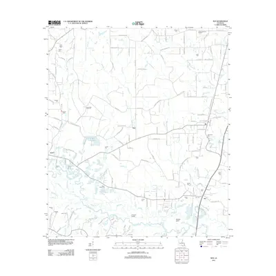
2012 Map of Sun
USGS Topo · Published 2012About this map
The Bogue Chitto river system dominates this landscape in northeastern St. Tammany Parish, where it splits into a complex network of channels including the Old River and Little River. The waterway creates significant landforms like Coopers Island and Holdens Island, reflecting a terrain shaped by dynamic river movement. Settlements such as Sun, Rio, Stein, and Isabel are connected by a rural road network that follows the high ground between numerous tributaries like Wrights Cr and Talleys Cr.
Find a feature on this map
94 named features on this map. Tap any name to fly to it.
Don’t see what you’re looking for? This feature index may not catch every label — zoom into the map to look around manually.
Map Details
Editions of this 2012 Sun Map
This is the sole edition of this map. No revisions or reprints were ever made.
Other maps of this area

1939 · Zona
USGS Topo · 1:31,680

1942 · Waldheim
USGS Topo · 1:31,680

1942 · Thigpen
USGS Topo · 1:31,680

1942 · Talisheek
USGS Topo · 1:31,680

1942 · Rio
USGS Topo · 1:31,680

1942 · Walkiah Bluff
USGS Topo · 1:31,680

1942 · Pools Bluff
USGS Topo · 1:31,680

1949 · Bogalusa East
USGS Topo · 1:31,680

1949 · Bogalusa West
USGS Topo · 1:31,680

1953 · Mobile
USGS Topo · 1:250,000