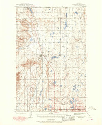
1939 Map of Sunburst
USGS Topo · Published 1968About this map
The international border between Canada and the United States defines the northern edge of this high plains landscape, where the town of Sweetgrass serves as a primary port of entry. In the late 1930s, the region was a center of industrial activity, evidenced by the numerous company housing nodes such as Ohio Camp, Texas Pacific Camp, and California Camp. These settlements, along with the towns of Sunburst, Kevin, and Ferdig, are linked by the Great Northern railroad and Route 91, tracing a corridor through the arid terrain. The map reveals an extensive network of oil and gas wells scattered across Willshaw Flats and near Buckley Coulee, highlighting the energy-driven economy of Toole County. Local education is anchored by rural institutions like Willshaw Sch and Superior Sch, providing a view of the social infrastructure supporting the oil field workers and ranching families of this era.
Find a feature on this map
16 named features on this map. Tap any name to fly to it.
Don’t see what you’re looking for? This feature index may not catch every label — zoom into the map to look around manually.
Map Details
Editions of this 1939 Sunburst Map
3 editions found
Other maps of this area

1909 · Cut Bank
USGS Topo · 1:125,000

1912 · Cut Bank
USGS Topo · 1:125,000

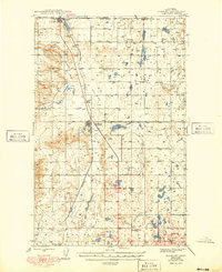
1939 · Sunburst
USGS Topo · 1:62,500

1943 · Antelope Coulee
USGS Topo · 1:62,500

1943 · Shelby
USGS Topo · 1:62,500

1945 · West Butte
USGS Topo · 1:62,500

1954 · Shelby
USGS Topo · 1:250,000

1958 · Shelby
USGS Topo · 1:250,000

1960 · Cut Bank
USGS Topo · 1:250,000

1963 · Cut Bank
USGS Topo · 1:250,000