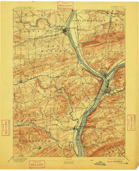
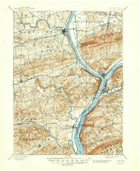
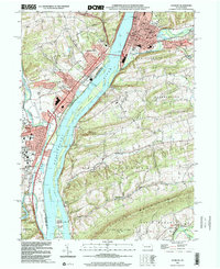
1893 Map of Sunbury
USGS Topo · Published 1909About this map
The West Branch Susquehanna River serves as the central artery for this late 19th-century landscape, where the confluence with the Penn Canal North Branch at Northumberland highlights the era's sophisticated transport network. The industrial and educational foundations of the region are evident at Lewisburg, featuring the Bucknell campus, and south to the river-port of Sunbury. The mapping reveals a complex web of early infrastructure, including the Penn Canal running parallel to the river and several competing rail lines such as the Lewisburg and Tyrone R.R. and the Sunbury and Lewistown R. R.. Beyond the main river towns, the terrain transitions into the ridges of Montour Mountain and Shamokin Mt., sheltering smaller interior settlements like New Berlin and Freeburg. This 1891 survey captures the valley before the full transition from canal-based commerce to dominant rail transport, preserving the location of early crossings like Fishers Ferry.
Find a feature on this map
68 named features on this map. Tap any name to fly to it.
Don’t see what you’re looking for? This feature index may not catch every label — zoom into the map to look around manually.
Map Details
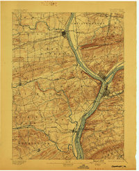
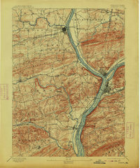
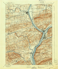
Editions of this 1893 Sunbury Map
6 editions found

Historical Maps of Sunbury Through Time
11 maps found
1893 Sunbury
Northumberland County, PA

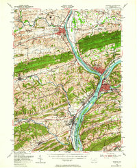
1943 Sunbury
Northumberland County, PA
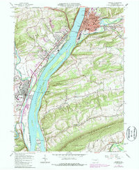
1953 Sunbury
Northumberland County, PA
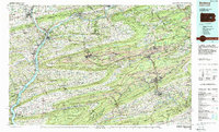
1965 Sunbury
Northumberland County, PA
1984 Sunbury
Northumberland County, PA
1999 Sunbury
Northumberland County, PA
2010 Sunbury
Northumberland County, PA
2013 Sunbury
Northumberland County, PA
2016 Sunbury
Northumberland County, PA
2019 Sunbury
Northumberland County, PA
2023 Sunbury
Northumberland County, PA