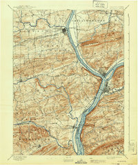
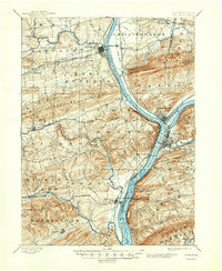
1893 Map of Sunbury
USGS Topo · Published 1940About this map
The confluence of the West Branch Susquehanna River and the main branch of the Susquehanna River dominates this landscape, where the towns of Sunbury and Northumberland established themselves as critical river-and-rail junctions. Surveyed in 1891, the map documents a complex industrial transportation network, featuring the Penn Canal running parallel to the water and several major rail lines, including the Catawissa Div. and the Sunbury and Lewistown R.R.. This infrastructure supported the movement of goods between the Central Pennsylvania coalfields and the valley’s agricultural centers.
Find a feature on this map
62 named features on this map. Tap any name to fly to it.
Don’t see what you’re looking for? This feature index may not catch every label — zoom into the map to look around manually.
Map Details
Editions of this 1893 Sunbury Map
6 editions found
Other maps of this area

1892 · Lykens
USGS Topo · 1:62,500

1892 · Shamokin
USGS Topo · 1:62,500

1893 · Sunbury
USGS Topo · 1:62,500

1893 · Lykens
USGS Topo · 1:62,500

1893 · Shamokin
USGS Topo · 1:62,500

1893 · Millersburg
USGS Topo · 1:62,500

1907 · Millerstown
USGS Topo · 1:62,500

1921 · Williamsport
USGS Topo · 1:48,000

1923 · Williamsport
USGS Topo · 1:62,500

1924 · Milton
USGS Topo · 1:62,500